Boundaries
This area extends from the Ottawa River in the north to the Queensway in the south and Green’s Creek in the east to the Aviation Parkway in the west.
History
One of the first major developments in this area was the Rockcliffe Air Station (later CFB Rockcliffe) in 1920. To the east, the Montreal Road campus of the National Research Council took shape mainly between the late 1930s and the mid-1950s. On the neighbourhood’s western edge, the Montfort Hospital opened in 1953.
Almost all of the residential development in the area has taken place since the Second World War. Many of the houses in Beacon Hill (named for a long-gone Ottawa River lighthouse) and Rothwell Heights date to the 1960s and 1970s. Carson Grove is a bit newer, with about half the houses built after 1980. The now-decommissioned CFB Rockcliffe is being developed into a new community called Wateridge Village.
Claim to fame
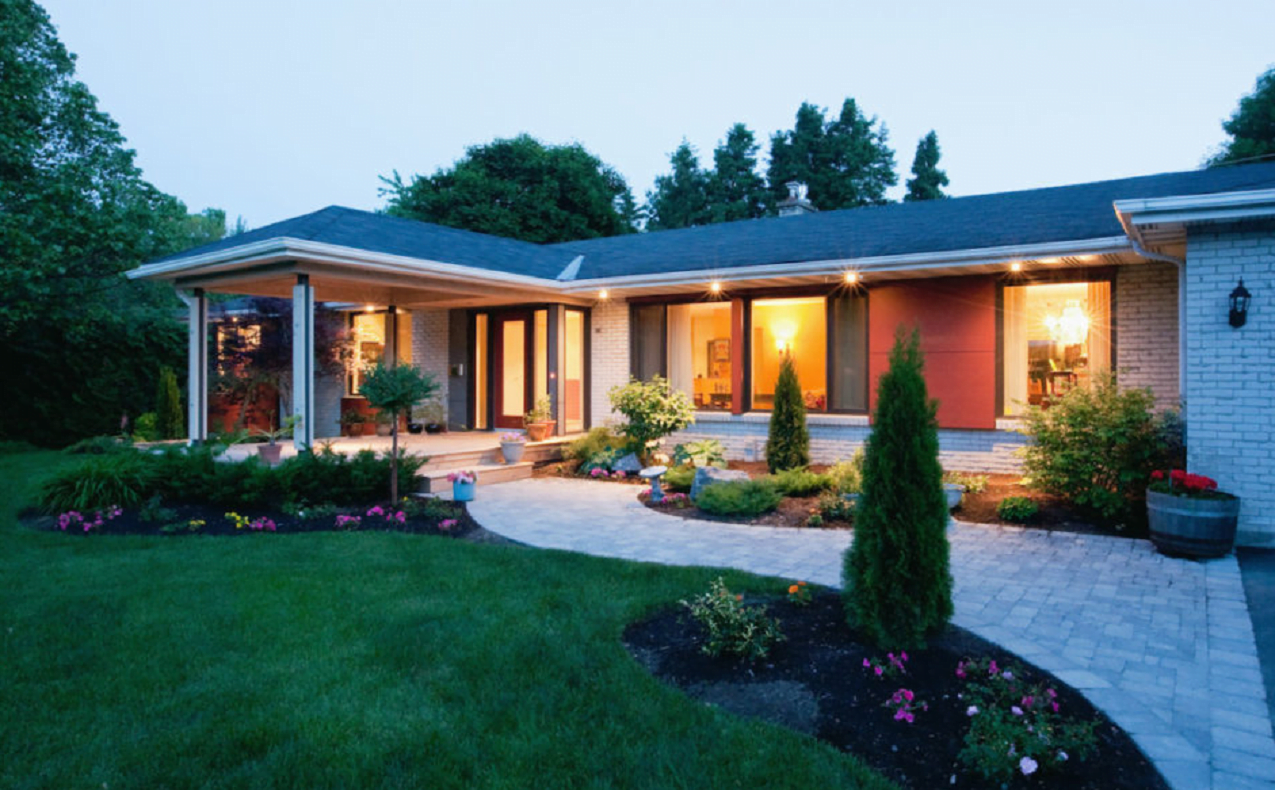
Rothwell Heights is known for its well-preserved mid-century modern homes. In fact, a small area called Briarcliffe (basically two streets, Briarcliffe Drive and Kindle Court) was declared an Ontario Heritage Conservation District in 2013.
Area neighbourhoods
There are multiple neighbourhoods in Rothwell Heights–Beacon Hill–Carson Grove:
- Rothwell Heights
- Viscount Alexander Park
- Carson Grove
- Carson Meadows
- Cardinal Heights
- Beacon Heights
- Wateridge Village
- Beacon Hill North and South
Who’s building where
- Wateridge Village: Mattamy Homes
New-build rentals
- Brownstones: Richcraft Rentals
In the area
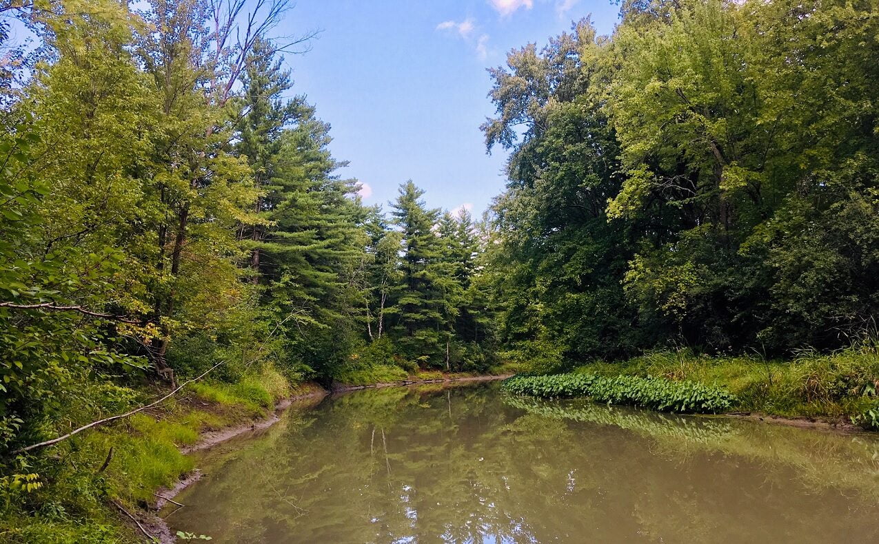
The area has a mix of homes, with large and exclusive properties predominating in Rothwell Heights (where a 15,000-square-foot mansion built in 2007 sold for $7.675 million in 2014) and more modest bungalows, townhomes and other housing types elsewhere. Attractions include the Ottawa River, the Greenbelt, and yacht and flying clubs.
Schools
Rothwell Heights–Beacon Hill–Carson Grove has English and French public and Catholic schools at all levels, except for a French public high school (the closest one is in nearby Blackburn Hamlet).
- English public: Ottawa-Carleton District School Board
- English Catholic: Ottawa Catholic School Board
- French public: Conseil des écoles publiques de l’Est de l’Ontario
- French Catholic: Conseil des écoles catholiques du Centre-Est
Businesses
This neighbourhood is home to several major employers, including the National Research Council, the Communications Security Establishment, the Montfort Hospital and the Canada Mortgage and Housing Corporation. An industrial area on the area’s northeastern edge, which includes a major wastewater treatment centre, provides further employment. Other businesses include:
- Big Rig Kitchen and Brewery
- Crust and Crate
- Cosmic Adventures
- Dominion City Brewing Company
- Chahaya Malaysia
- The Newfoundland Pub
- Creole Sensations
- Walmart
- Costco
- Canadian Tire
- Loblaws
- Farm Boy
- Chapters
- Starbucks
Amenities
The neighbourhood has a full range of sports facilities, including baseball diamonds, tennis courts, soccer fields, rinks and parks. Amenities include:
- Gloucester Centre
- Blair LRT Station
- Beacon Hill Shopping Centre
- Scotiabank Theatres
- Montfort Hospital
- La Cité Collégiale
- Earl Armstrong Arena
- Richcraft Sensplex
- Splash Wave Pool
- Ottawa Public Library (North Gloucester branch)
- Ski Hill Park
- Canada Aviation and Space Museum
- Pine View Golf Course
- Greenbelt
- Rockcliffe Yacht Club
- Rockcliffe Flying Club
- Boat launch (north end of Blair Road)
- Recreational pathways along the Ottawa River
Services
The neighbourhood offers a wide range of services, including banks, retirement homes, salons, dry cleaners, doctors’ and dentists’ offices, animal hospitals, and churches. The City of Ottawa’s Recreation and Parks Department offers a range of activities.
Transit options
“The Split,” where the Queensway branches off from Highway 417 to follow Highway 174, is at the southwestern corner of the neighbourhood. Residents can access the Queensway through interchanges at Blair Road and Montreal Road. Multiple OC Transpo bus routes serve the neighbourhood and many of them are feeder routes funnelling riders into the Blair LRT station, the Confederation Line’s eastern terminus, next to Gloucester Centre. Bike paths run along the Ottawa River at the northern boundary of Rothwell Heights, through Beacon Hill and Beacon Hill Heights, and elsewhere.